- Home
- Alistair Moffat
To the Island of Tides Page 3
To the Island of Tides Read online
Page 3
Perhaps one of my most eccentric possessions is a series of annual volumes published by the Berwickshire Naturalists’ Club. Founded in 1831 by Dr George Johnston of Berwick-upon-Tweed, it is the oldest active natural history field club in Britain and its object (what would now be called a mission statement) is pleasingly limited. Members are interested in ‘investigating the natural history of Berwickshire and its vicinage’, while the club badge carries the figure of a wood sorrel, Johnston’s favourite flower, and the motto is Mare et Tellus et quod Omnia, Coelum – ‘The Sea and the Land and what covers all, the Heavens’. Wonderful. Especially the use of the obscure ‘vicinage’ instead of vicinity.
From the BNC, I discovered that in the summer of 1930 a group of members had visited what they reckoned to be the ancient village of Wrangham between Kelso and St Boswells. Their guide, Rev. W.L. Sime, pointed to a row of ancient ash trees at Brotherstone Farm, saying that it grew where the village once stood. Andrew Armstrong’s map of the Borders made in 1771 also plotted its remains at the farm. This immediately caught my interest because I had been reading the Anonymous Life of St Cuthbert in the excellent translation by Bertram Colgrave, a scholar at the University of Durham. There are three eighth-century versions of lives of Cuthbert, two written by that more venerable and very great scholar Bede of Jarrow, but the earliest is the anonymous text almost certainly written by a monk on Lindisfarne between 699 and 705, only twelve or at most eighteen years after Cuthbert died.
The first Life is also more richly detailed than the others and contains what sounds like testimony from monks who knew Cuthbert. The account of his miracles and deeds feels at once more personal, more authentic, less formulaic, less political. It seems that Cuthbert was of Anglian rather than native Celtic descent (his name itself suggests that); the son of a landed, perhaps noble family, for the young boy was sent to be fostered, a common practice in early medieval Britain and Ireland and a means of extending bonds of loyalty and obligation amongst ruling elites. The prime purpose of both Bede’s and the Anonymous Life was to establish Cuthbert’s cult of sainthood and recount the miracles he wrought with God’s help. Here is a passage from the earlier Life that also imparts a little biographical detail:
At the same time the holy man of God was invited by a certain woman called Kenswith, who is still alive, a nun and a widow who had brought him up from his eighth year until manhood, when he entered the service of God. For this reason he called her mother and often visited her. He came on a certain day to the village in which she lived, called Hruringaham; on that occasion a house was seen to be on fire on the eastern edge of the village and from the same direction a very strong wind was blowing, causing a conflagration.
Cuthbert fell to the ground and began to pray, and miraculously the wind began to blow from the west and the rest of the village was saved. Over time, the place-name of Hruringaham was rubbed smooth into Wrangham and, to add to the findings of the Berwickshire Naturalists, archaeologists have more recently detected the remains of an ancient village near the modern farm of Brotherstone on the slopes of the Brotherstone Hills above the road between Kelso and Melrose.
Here is another description of a miraculous event from the Anonymous Life:
On another occasion, also in his youth, while he was still leading a secular life, and was feeding the flocks of his master on the hills near the river which is called the Leader, in the company of other shepherds, he was spending the night in vigils according to his custom, offering abundant prayers with pure faith and a faithful heart, when he saw a vision which the Lord revealed to him. For through the opened heaven – not by a parting asunder of the natural elements but by the sight of his spiritual eyes – like blessed Jacob the patriarch in Luz which was called Bethel, he had seen angels ascending and descending and in their hands was borne to heaven a holy soul, as if in a globe of fire. Then immediately awakening the shepherds, he described the wonderful vision just as he had seen it, prophesying further to them that it was the soul of a most holy bishop or of some other great person. And so events proved; for a few days afterwards, they heard that the death of our holy bishop Aidan, at that same hour of the night as he had seen the vision, had been announced far and wide.
What Cuthbert saw, and whether or not it really was a miracle rather than a meteorological event, seemed much less important to me than where he saw it. From all that I had read and researched, it was clear that he had been raised at Brotherstone/Wrangham, not far from the junction of the River Leader with the Tweed, and that he had had a remarkable, transcendent experience, probably in the Brotherstone Hills.
In 2000, I first became interested in Cuthbert when I was writing what I hoped would be a definitive history of the Scottish Borders (it ignored the border for the early part of the story) and I knew that up on one of the Brotherstone Hills there were two impressive standing stones known, of course, as the Brothers’ Stones. A third had been raised some way down the eastern slope and called the Cow Stone. I wondered if that place of even older, prehistoric sanctity was where Cuthbert had been tending his flocks and where he had seen the angels and Aidan’s soul ascend.
I had never been up to the Brothers’ Stones and so, having fed, watered and walked the dogs that sunny morning in July, I pulled on my boots and drove over to Brotherstone. Or at least I thought I did.
Having crossed the magnificent new bridge over the Tweed and then the much older and narrower bridge over the Leader, I drove east towards Kelso before turning left up a short farm track. There was no sign, but the Ordnance Survey suggested this was Brotherstone and glowering above the steading I could see the south-facing cliff of a steep crag. Having rung the doorbell of the farmhouse and had no reply except the furious barking of a very angry guard-dog, mercifully behind the back door, I walked over to a courtyard of cottages. A lady assured me it was OK to park and she would let the farmer know I was planning to walk up to the stones.
Every fence seemed to be electrified and so I carefully ducked under the wire at all of the gates. It was a thick gauge intended to give straying cattle a real jolt. Below the crag I found what looked like a warren of fox holes, or maybe a badger sett. Whatever creatures had excavated the rich, red earth, they had not troubled to seek the cover of gorse thickets or even long grass, and by the dyke lay the eviscerated carcase of a lamb, recognisable only by the largely untouched head, its clouded eyes bulging. Odd.
I skirted the crag and climbed up to a wide ridge of rough grazing made into large parks by long runs of drystane dyking. In front of each was a low electric wire and when I looked for a gate leading me in the direction I wanted to go, there seemed to be none. Perhaps this was a farm boundary. By this time the sun had strengthened and I was regretting not wearing a hat. When I came upon a tumbled section of dyke, I crawled under one electric wire and scrambled up over the stones to see another on the far side. The ground beyond it was obscured by tall nettles and so I had no means of judging how much of a drop it was. But did I really want to climb back down and carry on looking for a gate? When I jumped down, my right foot glanced off a hidden stone and I was lucky not to twist my ankle or worse. This gentle walk up a low hill was turning into a business.
When I reached what I reckoned to be the summit, there were no standing stones to be seen anywhere, only another slightly higher summit about two hundred yards further east. When I reached it, more disappointment waited, more head-scratching, more bewildered consultation of my map. I tried to locate a strip of sitka spruce below me and relate it to the route I had taken. My map was from the old Pathfinder series, about thirty years old and sitkas grew quickly. Was it too old to show the strip? And then it dawned. The unnamed farm where I parked could not have been Brotherstone. Instead of telling her I was going up to see the stones (she must have thought I was taking the scenic route), I should have checked with the lady at the cottages that I was in the right place.
As I marched back downhill and slid and scrambled under more electric fencing, very warm by no
w, with flies buzzing around me, trying not to become bad-tempered, I remembered another spectacularly bad piece of map-reading more than fifty years before, one that made me smile.
In the mid-1960s orienteering was a new sport in Scotland, imported from the forests of Scandinavia, and at Kelso High School we had Mr Climie, a real enthusiast. Having taught us the basics of map-reading with a Swedish Silva compass, we were then told to set off in search of a series of controls or check-points hidden in the Bowmont Forest, near Kelso. It seemed like good fun, very different, thinking and running at the same time. For the 1965 Scottish Schools Championships we went up to the vast forests around Aberfoyle in Highland Perthshire. The idea was to run around a course in the correct sequence and have your map time-stamped by the officials at each control. The fastest team would be the winners.
In our team of four I was last to go and almost immediately made a catastrophic error. I read my compass bearing 180 degrees wrong and ran round the course backwards, arriving at the finish, which turned out to be the start. My three team-mates had made good times, but to win we needed all four competitors to complete, even though my time would be terrible. They shouted to me that there was only forty minutes to go before the course and the competition would shut down. I turned round and set off again, knowing exactly where all the controls were, having already visited them – in reverse order. I re-appeared at the gate into the field where the finish was with only a few minutes remaining and, responding to the agitated cries of my teammates, I sprinted home and we won – just.
Having discovered the sign for the real Brotherstone Farm, I finally managed to park in the right place and began once more to walk uphill. A very rough and pitted track ran off to the west, and so I ignored it and climbed a gate to join another that ran to the north-east, the direction I wanted to go. Or so I thought.
Almost immediately I was met by a wall of very dense and prickly gorse bushes. Having turned to the west, I then ran into another insurmountable obstacle: the sheer face of an old sandstone quarry. It seemed that Cuthbert and the Brothers’ Stones were working hard to keep their secrets. In fact all of my journey to Lindisfarne would turn out to involve mistakes and more than a little effort, emphatically not a tour guided by a handbook or a reliable map, either paper or cerebral. I had guessed that ‘pilgrimage’ would probably involve adversity, but not that most of it would be self-inflicted.
When I began to wade through waist-high willowherb and nettles to the side of the quarry, the sun had climbed high in the sky and a cloud of flies was circling around my damp hair and forehead. But then the weeds and the gorse thinned and the walking suddenly improved as I breasted the ridge above the quarry. And there in the distance, on the crown of the easternmost of the Brotherstone Hills, clearly silhouetted against a cobalt-blue sky, was a tall standing stone.
A well-used track, rutted by wheeled vehicles, led up to the stone and gradually I saw that it was the same one that had seemed to swing away out to the west. It had turned towards the sitka spruce plantation and then aimed directly at the summit of the hill. The walking was easy and, as I climbed, the vistas on all sides began to reveal themselves. They were panoramic, long views to all points of the compass, some of them more than twenty miles. A breeze began to cool me, the flies fled and I walked the last few hundred yards in a good rhythm.
As I neared the summit of the hill, the second stone revealed itself, having been hidden by a rocky outcrop. Both were very bulky, not like the slender slivers of the Stones of Stenness, or the Ring of Brodgar on Orkney, or Calanais on the Isle of Lewis, and they no doubt weighed many tons. The taller Brother towered over me at well over two and a half metres and the other was shorter, more stumpy. As if ignoring these majestic, dramatic ancient monuments to a forgotten faith, the farm track ran precisely between them before dipping downhill towards the Cow Stone. It too was very bulky, standing about three hundred metres to the north-east, looking as though it had been carefully placed in some sort of alignment with the stones up on the summit. But the tracks of modern traffic could not diminish the magic of this place.
Probably dragging them with ropes over log rollers, the people who erected the stones on Brotherstone Hill expended great labour to set them there. But while the details of their religious rites will almost certainly never be discovered, the reason why they raised the standing stones on the hill could not have been clearer to me. The panorama was so vast, so heart-piercingly beautiful in the midday sun, that to stand by the Brothers’ Stones and simply gaze at it was thrilling.
Below us the valley of the Tweed, the great, life-giving river, widens as the Tweed winds its way east to the sea between the sheltering hills. To the south rise the foothills of the Cheviots, and I could see the rounded shape of Yeavering Bell, a place Cuthbert would come to know. Clouds clustered over the long hump of Cheviot itself and my eye was led to the watershed ridge running west, the line of the English border, where I could pick out the twin peaks of the Maiden Paps. Closer is the conical, volcanic shape of Ruberslaw and beyond it the hills of the Ettrick Forest. Much closer rise the Eildons, Roman Trimontium, the three hills that dominate the upper Tweed Valley: Eildon Hill North, Eildon Mid Hill and Eildon Wester Hill.
To the north-west, also close, is Earlston Black Hill, Dun Airchille, the Meeting Fort – all places where the strangeness and romance of Thomas of Ercildoune, True Thomas, Thomas the Rhymer, still clings. A prophet who foresaw the death of Alexander III in 1286 and whose predictions were widely believed and repeated, Thomas was perhaps the most famous Scotsman of the Middle Ages. The low ridges of the Lammermuirs lie to the north, many studded with groups of elegant white wind turbines, their sails turning lazily in the breeze. And standing up proud above the horizon in the north-east, I could easily make out the summits of Great Dirrington Law and Little Dirrington Law.
Forming a vast natural amphitheatre, the hills surround the courses of the great river and its tributaries on three sides. On the fourth, to the east, the horizon dips low as the patchwork of ripening fields edge down towards the seashore. With a hand on the cool mass of the taller of the two Brothers, its surface smoothed by the winds, rain and snows of 5,000 winters, I looked and looked out over a landscape I know intimately but one I had never gazed upon from this place. And somewhere in my memory, deep inside my sense of myself, the warmth of an old love began to glow once more.
I was born and raised in the valley of the great river and I know that my ancestors have been on the banks of the Tweed for many, many centuries, ploughing the fields, coaxing food from the soil, perhaps seventy generations living and dying within sight of the sheltering hills. The rich red and black earth is grained in my hands. But as I grew older, sat and passed (mostly) exams, heeded the advice of my parents ‘to get on’ and ‘stick in at the school’ and ‘make something of yourself’, I knew I would have to leave, have to tear up deep roots and go and live somewhere else. And so I did. After university at St Andrews, Edinburgh and London, I was, to my amazement, appointed to run the Edinburgh Festival Fringe in 1975 and despite my youth (I was twenty-five) and inexperience, I made a success of it. My big break; it led to everything else and a twenty-year career in television that brought rewards and occasional satisfaction. But I always nursed a need to come home, to return to the Tweed Valley, and having bought our little farmhouse, I decided to resign my well-paid job and begin the precarious life of a freelance writer. At forty-nine, I still had energy and ambition. And so for almost twenty years I have lived and worked in the Scottish Borders – and gradually taken all of its beauties and glories for granted.
When I climbed the hill to look at the stones, I had given little thought to the hill itself, the place the old peoples had chosen, but when I looked out from it, the elemental power of its beauty flooded back, an uncomplicated, unconditional love for the fields, forests, hills and intimate valleys of my native land, my home-place. That reminder was to be the first of Cuthbert’s gifts.
And up on the hill, hist
ory was whispering. The Eildon Hills to the south-west rose abruptly from the floodplain of the Tweed, their flanks steep, their three-summit outline dramatic and distinctive. The name ‘Eildon’ derives from Old Welsh, the language spoken by native communities before Cuthbert and my Anglian ancestors brought early versions of English, and it means ‘the old fortress’. It was attached to one summit, to Eildon Hill North, and it is closest to Brotherstone Hill. The name described a long perimeter of double ditching dug some time at the outset of the first millennium BC. But it cannot have been defensive. Probably topped by a palisade of wooden posts, the ditching runs for a mile around the crown of the hill, and instead of one or two gateways it has five. A huge force of defenders would have been needed to man these ramparts, especially the weak points at the gates, and if they had, they would soon have been thirsty. There is no spring or source of water other than what fell from the sky.
Eildon Hill North was not a fort but a temple, and a place of spiritual and temporal power. Inside the long perimeter, more than three hundred hut platforms have been found, enough to house a population of about three thousand. Lack of water and the need for all provisions to be lugged up the steep slopes probably meant a temporary occupation of these huts, almost certainly for significant points in the year; times of celebration, worship, perhaps sacrifice and perhaps propitiation of whatever gods were believed to govern the lives of mortals 3,000 years ago.
The oldest calendar in Britain revolves around the half-forgotten turning points in the farming year of the native Celtic peoples. It begins at the end of October with Samhuinn – in Gaelic: ‘the end of summer’. It is now Christianised as Hallowe’en and seen as the beginning of winter and the moment when the clocks change. But the remnants of ancient, pagan practices still survive and versions of these would likely have been enacted by those who climbed Eildon Hill North on Samhuinn Eve.

 The Secret History of Here
 The Night Before Morning
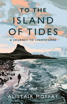 To the Island of Tides
 Arthur and the Lost Kingdoms
 Britain’s Last Frontier
 The Faded Map: The Lost Kingdoms of Scotland
 The Wall