- Home
- Alistair Moffat
The Faded Map: The Lost Kingdoms of Scotland
The Faded Map: The Lost Kingdoms of Scotland Read online
The Faded Map
The Faded Map
LOST KINGDOMS OF SCOTLAND
Alistair Moffat
This edition published in 2011 by
Birlinn Limited
West Newington House
10 Newington Road
Edinburgh
EH9 1QS
www.birlinn.co.uk
First published in 2010 by Birlinn Ltd
Copyright © Alistair Moffat 2010
Photographs copyright © Liz Hanson 2010
The moral right of Alistair Moffat to be identified as the author of this work has been asserted by him in accordance with the Copyright, Designs and Patents Act 1988
All rights reserved. No part of this publication may be reproduced, stored or transmitted in any form without the express written permission of the publisher.
eBook ISBN: 978-0-85790-057-9
British Library Cataloguing-in-Publication Data
A catalogue record for this book is available from the British Library
For Hugh Andrew
Contents
List of Illustrations
Introduction
1 Shadows
2 The Faded Map
3 As If Into a Different Island
4 Kingdoms Come
5 After Rome
6 The Baptised
7 Bernicia
8 Strathclyde
Bibliography
Index
List of Illustrations
The Catrail, near Galashiels
Callanish, Lewis
The Lochmaben Stane
The upper Solway Firth at low tide
The site of Flanders Moss
Traprain Law, East Lothian
Addinston Fort, the site of the Battle of Degsastan
Burnswark Hill
Dumbarton Rock
The Antonine Wall at Rough Castle
Hadrian’s Wall, showing the Whin Sill
Bennachie, the site of Mons Graupius
The Farne Islands, looking towards Bamburgh Castle
Bamburgh Castle
Lindisfarne Castle
Roxburgh Castle
From Roxburgh Castle, looking east
The site of the monastery of Old Melrose
The Eildon Hills
Bewcastle Church, Cumbria
Bewcastle Cross
Manor Valley
St Gordian’s Cross, Manor Valley
Stirling Castle
Edinburgh Castle
Introduction
VERY LITTLE CERTAINTY, only occasional phases of continuity and hardly any clarity at all are the sorry string of characteristics to be found everywhere in this book. Scotland or, more precisely, north Britain in the Dark Ages seems a tangle of confusion, a story told in sometimes contradictory fragments and a few rare flickers of light. From late in the last millennium BC to AD 1000 and even beyond, it is a tale of shadows and half-lit edges.
Only the land, its rivers and lochs and the seas around it remain and, although the appearance of Scotland has changed over the course of a thousand winters and a thousand summers since, its fundamental shape and scale have endured. The sands and the tides, the hills and high valleys, the great rivers, the long-lost wildwood, the impenetrable marshlands and the ancient names of places have a rich story to tell. The land has its own certainty, continuity and clarity and, where it can, this book attempts to thread these into the weave of our early history.
Such as it is, much of what we might recognise as a history of Scotland in the first millennium AD has been supplied by outsiders. Greek travellers, Roman military historians and map makers, Irish annalists, Welsh bards and chroniclers now thought of as English have left us most of what passes for a narrative in what follows. Much has been lost and often it is the random discovery of an object, the recognition of a piece of dusty sculpture as great art or the realisation that some of the men of the north of Britain were very influential in their time that reminds us that a lack of a coherent history written by those who lived it is only an accident. Because records did not survive, we should not drift into the unthinking assumption that the society of Dark Ages Scotland was incapable of compiling them and was therefore somehow primitive and less sophisticated than others.
As a further discouragement, it should be made clear at the outset that the principal focus of this book is failure. The losers have, of course, been eclipsed by the winners in the history of Scotland. Excellent treatments of the rise of Dalriada, the Gaelic-speaking kings of the west and their eventual takeover of the whole country exist. And the story of the Pictish kingdoms, one of the great mysteries of our history, has been investigated and exhausted by talented historians. The Scots and the Picts appear in this narrative only when they shed light on the peoples they defeated or subjugated.
Instead a dim light is shed on the forgotten dynasties that died away and failed. Their lost kingdoms are the proper subject of this book. Where were Calchvynydd, Desnes Mor and Desnes Ioan, Manau and the land of the Kindred Hounds? Who were the Sons of Prophecy, the Well-Born, Macsen, Amdarch, the kings of Ebrauc and the treacherous Morcant Bwlc? What happened at Arderydd, Degsastan and Alt Clut? Where were the Grimsdyke, the land of the Haliwerfolc, the sanctuary of St Gordian, the Waste Land and the Raven Fell?
Most of these lost or half-remembered names are to be found in the landscape, overgrown by ignorance, pushed to the margins of our history by events elsewhere. The limitations of this book are all too obvious but its geographical limits require a little explanation. It is principally the ‘faded map’ of southern Scotland, the lands south of the Highland Line. Those lost kingdoms that spoke dialects of Old Welsh are much discussed and the final flourishes of the remarkably resilient Strathclyde Welsh close the narrative. The other significant language of Lowland Scotland was of course English and a concerted and extended effort is made to assert the Bernicians as one of Scotland’s peoples. The arrival of their language and the glittering achievements of the dynasty of Aethelfrith are seen as a central part of Scotland’s history. Bernicia is a kingdom lost to us in the pages of histories of England.
Finally, a note on the boxed notes in the text: these deal with snippets of detail and related information and are of incidental importance in a story which needs every bit of information it can find.
It is to be hoped that in these pages the ‘faded map’ of Scotland will acquire some colour once more. The story of our lost kingdoms is not merely a matter of footnotes for the curious. Failure has its own fascination. Losers in our history deserve our attention and perhaps our respect. Scotland was never inevitable.
1
Shadows
IN FEBRUARY AND MARCH, the hungry months of the late winter, even the best fields are grazed hard, their grass pale and nibbled to its roots. Good farmers use every inch of pasture to nourish their pregnant ewes and, in the pillowy hills by the River Tweed, it is surprising to see a copse occupy a long stretch of good ground for no apparent reason. But it turns out that there is one. Deep in the tangle of briars and hawthorns and surrounded by a rusty barbed wire fence lies the shadow of an ancient kingdom. Perched on a south-facing hillside between Galashiels and Selkirk in the Scottish Border country, the long and prickly copse hides a stone-filled ditch with a steep bank on its northern edge. The farmer has fenced it to keep curious lambs from injury and mischief and left the scrub and tumbled tree trunks as a welcome shelter from the winter winds. Curious human beings who avoid becoming hanked on the barbed wire and push their way through the briar thorns will find themselves standing inside another time and another place. In the still of a summer evening, the dense canopy shades the lich
en-covered stones of the ditch and in the quiet glade there is a silence and the sense of a long past.
Nothing appears to be artificial – there are no obvious marks of the work of men and women and no signs of occupation. The deep ditch has been filled with stones picked up in the surrounding fields by generations of ploughmen and shepherds. None seems to have been carved or worked in any way. And yet this place was made by the back-breaking labour of many people, hacking soil and rock out of the earth with mattocks and picks, filling baskets, lifting them, carrying their loads to the bank above and piling the upcast ever higher. The ditch was deep – almost two metres in places – and, with the bank above it, the whole earthwork measured six metres across. This place was important. At least fourteen centuries ago, the ditch and its bank marked a frontier, the limits of two of the lost kingdoms of Scotland.
Known as the Catrail, the beginnings of the boundary have been traced a few miles to the north, near the banks of the Gala Water by Torwoodlee. As it climbs up the steep slopes above the flood plain, the ditch circles a broch, a stone tower probably built in the last centuries of the first millennium BC, perhaps occupying the site of an earlier hill fort. Formed with immensely thick drystane walls and circular in plan, the broch dominated the landscape, visible up and down the river valley, standing on a high and prominent spur. The frontier ditch skirted the great tower and it may be that, at some point in an overlapping history, the strength of one was associated with the integrity of the other.
After the line of the Catrail passes to the west of the modern town of Galashiels, it can be difficult to trace, often showing only as a shadow cast by early or late sun. When snow melts, the last of it sometimes lies where the old ditch has almost been ploughed out or filled in by farmers so that a slight depression is all that remains. As the Catrail reaches the tangled briar copse on the hillside between Galashiels and Selkirk, another tremendous fortification once reared up behind its line. On the summit of the ridge stands a plantation of spiky Norway spruces surrounded by a circular drystane dyke. Inside, screened by the evergreen trees, are the banks and ditches of an elaborate fort. Dug and palisaded some time in the first millennium BC, it is known as the Rink. An odd place-name, it is the stub of something longer and more revealing. Llangirick is, in part, an Old Welsh name coined by the communities who lived in the Borders before the arrival of English and the war bands who spoke its seventh- and eighth-century versions. Many Old Welsh place-names have survived. Peebles is from pybyll, which meant ‘a tent’ or ‘a shelter’ and probably referred to the shielings of shepherds or farmers. Kelso is from Calchvynydd, meaning ‘a Chalky Hill’. In Wales there are many llan names and it usually refers to ‘an enclosure’. There is a persistent local tradition that the second element of Llangirick is a memory of a Gaelic-speaking Scottish king. Giric reigned in the late ninth century and his war bands are said to have raided in the Tweed Valley. Perhaps they re-used the crumbling ramparts as a base for harrying the countryside around.
Below the Rink fortress, the frontier runs towards the banks of the Tweed and is picked up again immediately on the other side. What makes it almost certain that the Catrail was not a road but a boundary is the fact that it does not seek to ford rivers or pay much attention to natural features. In two places the ditch arrives at a sheer drop into a stream and carries on on the other side. Elsewhere its line goes from one side of a hill loch to the other and it often goes straight up ridges with no attempt to find an easier gradient.
Frontiers are the product of politics, of an agreement or bargain struck or at least a settlement of some kind, often a compromise. Another place-name suggests one. In the neck of land between the Tweed and the Ettrick before they meet below the Rink fort, lies Sunderland. An English name, it signifies territory separated or ‘sundered’ from a greater whole. The chronology may not fit (place-names are difficult to date) but in Sunderland there is a sense of an important boundary nearby, one which could not include it for some lost reason.
That reason may have been military. An alternative and equally plausible interpretation is that the construction of the Catrail was an act of war rather than an agreed peace. The ditch was almost always dug on the eastern or southern side of the earthwork and the bank raised to the north or west. That suggests that the Catrail was made to obstruct the advance of aggressors from the east, either mounted raiders or warriors on foot. And, if any did break through and had plundered cattle or other livestock, the ditch and bank would make it difficult for them to get away quickly with their stolen beasts.
The fact that several powerful fortresses lie close to the Catrail is also eloquent. They are always sited in the west or north and therefore behind the sheltering bank. And in turn that suggests strongly that this huge structure was thrown up by the peoples of the west and their kings.
Offa’s Dyke supplies useful analogies. Built by the great Mercian king in the eighth century, it was intended to inhibit raiding parties riding out of the Welsh hills. Although on a much larger scale than the Catrail, its principles are the same; there is a wide and deep ditch to the west and a high bank on the east made from the upcast. At 150 miles in length, from the Severn estuary to the Dee, it was a vast project, the largest archaeological monument in Britain and the most impressive man-made frontier in Europe. Land was the most precious asset our ancestors had and kings did not hesitate to expend enormous energies to protect it.
To the west of Selkirk, the Catrail is much harder to detect as it climbs into the hills above the Yarrow Valley. It may be that this long stretch was dug at a different period and guided by different authority. After crossing the river near the Yarrow Feus, the frontier swings south through the high wastes of the old Ettrick Forest before becoming much more defined as it reaches the Borthwick Water. Now engulfed by commercial forestry, the last few miles are, nevertheless, again emphatic, the ditch cut in long straight sections before terminating in the western ranges of the Cheviot Hills, near Peel Fell.
Earthworks are notoriously difficult to date. The most persuasive evidence for Offa having caused his dyke to be built during his reign, from 757 to 796, is to be found in Asser’s Life of King Alfred. Written 100 years after the event, the biography contains only one relevant sentence: ‘Offa caused a great dyke to be built from sea to sea between Mercia and Britain.’ The seas are assumed to be Severn Estuary and the Irish Sea while Mercia was Offa’s midland English kingdom and Britain was what is now Wales, seen by contemporaries as one of the last redoubts of the British. Written evidence like this is precious, much prized by historians of the so-called Dark Ages. And yet it is not entirely accurate. The northern section of Offa’s Dyke was never built and to maintain its line to the Dee Estuary and the Irish Sea, another huge earthwork, which lay a few miles to the east, was used. Known as Wat’s Dyke, it is forty miles long and was thought to be roughly contemporary with Offa’s Dyke. But archaeologists have recently found a fire site under Wat’s Dyke which was reliably carbon dated to around AD 446, much earlier than the reign of Offa.
No one has yet excavated the Catrail and parts of its fifty-eight-mile length may have been dug at different times or re-used older ditches and banks. Or the frontier may have been marked in different ways, and there were certainly substantial gaps where streams and sleep slopes seem to have sufficed. But the continuous 110 miles of Offa’s great dyke was certainly built in the second half of the eighth century, and it was thrown up quickly because of military pressure from the Welsh kings of the west. It seems highly likely that the Catrail had similar beginnings and for similar reasons.
Solid, physically imposing frontiers were very familiar to the communities of southern Scotland. They lived between two mighty Roman walls, the Antonine across the Forth–Clyde isthmus and Hadrian’s between the North Sea and the Irish Sea. But what was the military pressure in the western Tweed Basin that galvanised kings and lords to imitate the work of the legions?
In the seventh century, English-speaking war bands began raid
ing in the north. Riding out of the newly established kingdoms of Bernicia in Northumberland and Deira in Yorkshire, these warriors and their kings were ambitious, anxious to gain territory and prestige and successful in imposing overlordship in the Tweed Valley. In 603 a great general, Aethelfrith, led his war band to victory over the men of Aedan macGabrain, King of Dalriada. They fought at a place called Degsastan by the chroniclers, probably Addinston in Lauderdale. By 637 the English were laying siege to the seat of the Old Welsh kingdom of the Gododdin at Din Eidyn, now Edinburgh. Not recorded are the forays they made to the west, to the fertile farms and fields of the Upper Tweed. But make them they did for the seventh century saw native kings shrink back into their upland fastnesses and try to stem the tide of English takeover.
It is likely that these defeated, retreating rulers determined to draw a line through the Border hills, the frontier which has become known as the Catrail.
Further down the Tweed, English-speaking warlords were renaming the landscape. The old fortress at the junction of the Teviot and the Tweed, the strategic pivot known for centuries as Marchidun, became Hroc’s burh, the stronghold of the English warlord called the Rook. Roxburgh is the smoothed-out modern version. Much closer to the Catrail new settlements took a characteristic shape. At Midlem, originally Middleham, the village evolved as two rows of houses on either side of a central green and with long backlands behind. These were cultivated for many generations and show up well in aerial photographs. At Selkirk, on the flood plain of the Ettrick, a powerful magnate built a hall for himself and his warriors. It has left its name on the town. Selkirk is from Early English and it means the Hall Church. Only the faint traces of the wallstead, a large rectangle, can be seen from the air but the building was probably like its contemporaries. In the epic poem, Beowulf, King Hrothgar sat in a
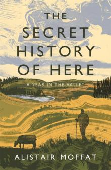 The Secret History of Here
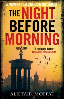 The Night Before Morning
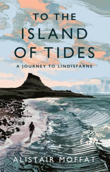 To the Island of Tides
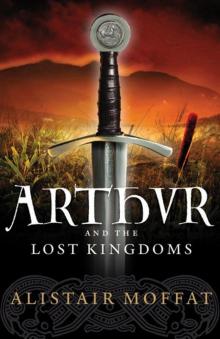 Arthur and the Lost Kingdoms
 Britain’s Last Frontier
 The Faded Map: The Lost Kingdoms of Scotland
 The Wall