- Home
- Alistair Moffat
Arthur and the Lost Kingdoms
Arthur and the Lost Kingdoms Read online
‘The text is packed with fascinating clues to life in the Celtic past gleaned from traditional cultural practices and changing place names. His new “common-sense” deductions are combined with succinct coverage of the documentary and archaeological evidence. Those who have read other books on Arthur will find a new dimension here. Readers new to the subject should find that the book provides a vivid and thought-provoking case for the Scots’
Birmingham Evening Mail
‘Adding flesh to conjectures is an enjoyable thing to do and Moffat adds more flesh than most’
Glasgow Herald
‘[Alistair Moffat’s] book, guaranteed to get up many noses, is to be recommended’
Spectator
‘Fascinating … It is great fun and a worthy addition to the enormous canon of Arthuriana’
Daily Post (Wales)
‘This book is a virtuoso performance, packing in an astonishing amount of information on a wide range of subjects. I found his description of the British-speaking Celts of his part of Scotland, their customs and beliefs, entirely convincing. And he manages to bring them to life more vividly than any author I can remember’
Cardiff Western Mail
Alistair Moffat was born and bred in the Scottish Borders. A former Director of the Edinburgh Festival Fringe and Director of Programmes at Scottish Television, he now runs the Borders and Lennoxlove book festivals as well as a production company based near Selkirk. He is also author of a number of best-selling books. In 2011 he was elected Rector of St Andrews University.
This ebook edition published in 2012 by
Birlinn Limited
West Newington House
Newington Road
Edinburgh
EH9 1QS
www.birlinn.co.uk
This edition first published in 2012 by Birlinn Limited
First published in 1999 by Weidenfeld and Nicolson
Copyright © Alistair Moffat 1999 and 2012
The moral right of Alistair Moffat to be identified as the author of this work has been asserted by him in accordance with the Copyright, Designs and Patents Act 1988
All rights reserved. No part of this publication may be reproduced, stored or transmitted in any form without the express written permission of the publisher.
ebook ISBN: 978-0-85790-226-9
ISBN: 978-1-78027-079-1
British Library Cataloguing-in-Publication Data
A catalogue record for this book is available from the British Library
CONTENTS
List of illustrations
List of maps
Acknowledgements
1 ANOTHER RIVER
2 AN ACCIDENTAL HISTORY
3 THE NAMES OF MEMORY
4 THE HORSEMEN
5 THE ENDS OF EMPIRE
6 AFTER ROME
7 THE KINGDOMS OF THE MIGHTY
8 PART SEEN, PART IMAGINED
9 THE MEN OF THE GREAT WOOD
10 THE GENERALS
11 FINDING ARTHUR
12 THE HORSE FORT
13 THE LANDS OF AIR AND DARKNESS
Bibliography
Index
ILLUSTRATIONS
The site of the lost city of Roxburgh
Part of an old wall which ran between the Dark Ages fort and the River Tweed
The Marchmound from the east
The Marchmound from the west
The castlemount from the south, with the River Teviot
An aerial survey of the Roxburgh site
Calchvyndd seen from across the River Tweed
The ruins of Kelso Abbey
The Trimontium Stone
Eildon Hill North
Scott’s View of the three Eildon Hills
The Yarrow Stone
The Hawick Horse: ‘Teribus Ye Teriodin’
The aerial survey of the Roxburgh site is reproduced by permission of HMSO. The other photographs are by Ken MacGregor.
MAPS
Britain circa AD 150
Arthurian Britain
The Scottish Borders
Eildon Hill North and its environs
Yarrow, the Warrior’s Rest and Annan Street
Kelso, the Abbey and Roxburgh Castle
LINE DRAWINGS
The Yarrow Stone
Trimontium
Roman cavalry helmet
Roman cavalry visor
Roman cavalry trooper wielding a spatha
Roman cavalry trooper with a contus
The draconarius
A Gododdin warrior
Ogham script
Arthur’s cavalry wait in ambush
Medieval Roxburgh and its castle
Marchidun circa AD 500
The site of the lost city of Roxburgh is now used for point-to-point horse racing and the jumps and pavilions are from a recent meeting. Behind them is the low plateau on which the city stood, and to its left is the castlemount.
Beneath the roots of this old chestnut tree lie the ruins of a substantial wall which begins to run towards the River Tweed to the left. The line of the wall is cut abruptly by the line of the modern Selkirk to Kelso road, which is embanked by a course of large dressed stones. These stones may be the remainder of the defensive ramparts thrown up by Arthur’s predecessors from the stronghold of Marchidun down to the river. The steep slopes of the fortress mound rise only ten yards from the right of the picture.
This is from the eastern end of the Marchmound and it shows a single fragment of medieval masonry on top of the ditched mound of the Dark Ages fort. The modern road runs to the right, cutting off a second defensive ditch on its down slope.
From the western end this offers a powerful sense of how massive the mound is, and how the labour of thousands of man-hours has improved on what geology created. The River Teviot is glimpsed to the right, and the Tweed to the left.
The castlemount seen from the south, with the River Teviot defending its flank. The run of the medieval walls can be seen to the left, while the site of the old city lies a hundred yards or so off to the right. The depth and width of the river, photographed in March, shows what a formidable obstacle it was, both to attackers and for horses kept out on the haughland in the winter, out of the campaigning season.
An aerial survey of the Roxburgh site.
Calchvyndd in the winter sunshine. The old chalk hill is hidden now by the terraced gardens of the large houses on its top and obscured in summer by the trees on the river island in the foreground. The Tweed is wide and deep here as it joins the Teviot at the Junction Pool.
The massive ruins of Kelso Abbey seen from the modern town.
The Trimontium Stone commemorates the complex of Roman military and civic sites which once stood in the lee of Eildon Hill North, whose flat summit dominates the area.
Taken near the time of the feast of Imbolc, in early March, this photograph shows Eildon Hill North in its setting of fertile farmland.
This is marked on the map as Scott’s View since the sight of the three Eildon Hills watching over his beloved Borderland moved Sir Walter Scott to write so much about his native place. It is said that when his horses drew Scott’s funeral carriage past the View, they stopped out of ancient habit. I hope that is true.
The Yarrow Stone, set on a hillside above the site of the Battle of the Wood of Celidon. The trees are mostly gone now, but the inscription on the stone remembers the clash of war in that place 1500 years ago.
The Hawick Horse. With its triumphant Border warrior bearing a raided English flag, it carries the enigmatic town motto, ‘Teribus Ye Teriodin’. Or ‘Tir Y Bas, Y Tir Y Odin’ – ‘The Land of Death, and the Land of Odin’, a long echo of the Ride of the Dead.
ACKNOWLED
GEMENTS
This book has been forming for so long in my mind that it is difficult to remember some of the early kindnesses shown by people whose knowledge far outran my own. But I cannot forget how important my father, Jack Moffat, was in developing my own interest in the history of the Scottish Border country and in particular in place names. As much for his own amusement as anything didactic, he used to muse on names out loud, turning them over and over to get at what they meant. In every sense he made me think about these things before I passed them by. I owe him a debt of love that I can only repay to his grandchildren, and this book is dedicated to them.
Walter Elliot is a kenspeckle figure whose visceral and intellectual knowledge of the Borders is encyclopaedic. By an entirely different route he arrived at precisely the same conclusion as I did, and I am grateful for his kindness in sharing what he knows, and for reading this manuscript. He thoughtfully corrected some blunders but any inaccuracies that remain are entirely my own.
David Godwin should have been a farmer such is his ability to distinguish wheat from chaff. For his good humour, kindness and enthusiasm I am very grateful. Benjamin Buchan edited this book with tact and a sure touch, while Anthony Cheetham published it with brio and no little bravery.
No one helped me more in the process of writing this than Eileen Hunter. She showed me a path through the wilderness of word processing and made my life much easier. And as I navigated through options, files, tools and the rest, she kept me on the straight and narrow more than a few times. Many thanks and much love, Eileen.
My old friend George Rosie has borne several monologues on car journeys from Glasgow to Edinburgh with great fortitude, and his excellent film Men of the North for S4C and Scottish Television was partly a product of conversations on the M8.
To my Welsh-speaking friends I owe thanks for honest answers to puzzling questions and to Iain Taylor and Rhoda Macdonald more gratitude for wisdom and guidance in Gaelic. I hope none of them wince when they see passages from their beautiful mother-tongues rendered down into mine.
Harriet Buckley drew the illustrations for this book with patience and skill and also according to my suggestions. Therefore all that is good-looking about her drawings redounds to Harriet’s credit and any mistakes originate with me. Ken MacGregor is an accomplished documentary film-maker as well as an excellent photographer, and several of his pictures are worth more than several thousands of my words.
Finally I want to acknowledge the tolerance of my family. I am glad that while I was writing this my wife Lindsay, and our children Adam, Helen and Beth, had other lives which they allowed me to visit when it suited me.
Alistair Moffat
Selkirk, 1999
To Adam, Helen and Beth with all my love
Britain circa AD 150
Arthurian Britain
1
ANOTHER RIVER
This is a story of Britain; a tale of the events and circumstances that first defined Britishness, resisted homogeneity and made these islands a collection of nations whose languages have survived to describe several versions of our present, and remember a past different from the one we think we know. It is also the story of a time when written memory fails us and when archaeology is imprecise; what historians have called our Dark Ages.
This is the story of Arthur; perhaps the most famous story we tell ourselves, certainly the most mysterious and least historical. He was a heroic figure who cast a mighty shadow over our history, colouring our sense of ourselves more deeply than any other. And yet he is elusive, barely recorded on paper or vellum and certainly not noted in the chronicles of his enemies, those who eventually won the War for Britain. But Arthur touched the landscape, and it remembered him.
That is where I came across his story, in the hills and valleys of Britain. At first I did not realize what I was looking at. When I began thinking seriously about this book, what I had in mind was something quite different. Originally I intended a miniature. Richly decorated, vividly coloured, pungent and full of interest perhaps, but a miniature for all that.
I was born and brought up in Kelso, a small town in the Scottish Border country and, quite simply, I wanted to write a history of the place because it will always mean home for me and the sight of it still warms me even after thirty years of absence. I had no ambition past capturing something of the essence of Kelso by setting down in reasonable order a chronicle of the years of its existence.
But almost as soon as I began my research, a series of unexpected and puzzling questions threatened to detour my straightforward purpose. Kelso first comes on written record in 1128 when monastic clerks drew up the abbey’s foundation charter. All of the villages, churches and farms detailed in the document must have been going concerns well before that date, and so I set about finding earlier references to the town and its hinterland. Scottish medieval records are notoriously scant but I was still surprised at the paucity of material. I could find only one mention of Kelso before 1128 in any sort of document at all. This was an English translation of a poem written in Edinburgh around 600. Not in Gaelic as you might ignorantly expect, or Latin, but in an ancient form of Welsh. Known as ‘The Gododdin’¹ it tells the story of the warriors of King Mynyddawg and their disastrous expedition to fight the Angles at Catterick in North Yorkshire. One of the Gododdin princes is named as Catrawt of Calchvyndd. I realized immediately that this is the oldest name for Kelso and also its derivation. In Old Welsh, Calchvyndd means ‘chalky height’ and not only is part of the town built on such an outcrop but the street leading to it bears a translation, the Scots name Chalkheugh Terrace. And in the 1128 charter Kelso is spelled Calchou. Calchvyndd and Kelso are clearly the same place.
But I found myself more than surprised to read the early history of the south of Scotland in Welsh, and more, to read of Welsh- speaking princes, kings and kingdoms in a place I thought I knew well. Who were these people? Where were these lost kingdoms? It seemed to me that there was another river running.
Catrawt and his Calchvyndd led me to ask many questions, but in particular he suggested place-names as a rich source for the early history of Kelso and the Scottish Borders. What I found gradually revealed to me was something remarkable: a story of Britain and, more, the historical truth of the most famous secular story in the world, what people miscall the Legend of King Arthur. Neither a legend nor a king, I found him remembered by the land, in the fields, Xrivers and hills of southern Scotland, and by extension by the people who farmed, knew and named where they lived. Unremarked by history, little people who walked and worked their lives for generations under Border skies. And also by looking hard at a small place I began to become aware of a much larger picture until, after a time, I could lift up a map of the Border country and see clearly the watermark of Arthur.
Before I go on to the meat of what I have found, I should make some confessions and assertions. As a historian I am an amateur, in the old sense of loving it, and emphatically not in the new sense of being sloppy or less than serious. I am certainly not an academic historian, not time-served and with no folio of published papers to act as pencil sketches for the big picture. Anyway, what academic would want to do something so literally amateurish as to write the history of his home town?² Aside from a decent education, I only have two claims to bring to the reader’s attention. The first is simple: since no one asked me to do this, I am not obliged to be anything other than my own man. I care nothing for academic reputation, the conventional wisdom or the weight of opinion. These researches are founded on common sense and sufficient erudition.
My second claim will take longer to unpack. It directly concerns my interest in the names of places, more properly toponymy, and how my knowledge of all this began.
When I was a little boy in the 1950s my dad took me with him in his van to summer jobs. He was an electrician who worked on Saturday mornings, often going out to the grand houses of the Borders to fit a plug on a kettle or replace a lightbulb for ancient aristocrats with servants still susp
icious of electricity. The toffs, as he labelled them, did not interest him much but my dad was fascinated by their land and their ability to hang on to it and shape it to their purposes. One Saturday he took me to a place called the Hundy Mundy Tower. Standing in the dank wood almost completely hidden, it was a chilly, creepy building resembling the gable end of a Gothic cathedral. My dad explained that it was a folly designed to finish a vista from the windows of a big house. The trees had been planted to add mystery and spurious antiquity. ‘Power,’ he said to me many years later, ‘that is real power; being able to alter the landscape to suit one man’s idea of a good view and invent a bit of history forbye.’
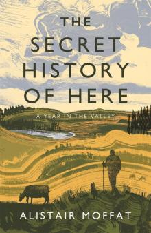 The Secret History of Here
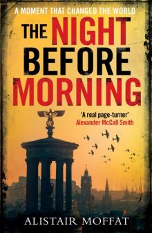 The Night Before Morning
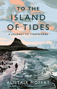 To the Island of Tides
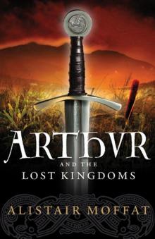 Arthur and the Lost Kingdoms
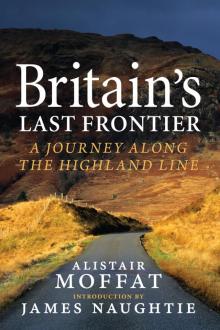 Britain’s Last Frontier
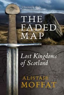 The Faded Map: The Lost Kingdoms of Scotland
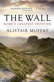 The Wall